|
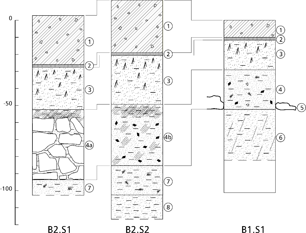
Fig. 29: Two profiles showing the integration
of the wall remains B2 in the surrounding sediment deposits. The profile labeled
B1.S1 (right) is identical to the one from Fig. 10 (structure B1).
Keys: 1. Silt, yellow, heterogeneous: disturbed accumulation (actual terracing
work); 2. Grass surface with roots; 3. Organic humus, silty, brown, homogeneous,
fine rootlets: naturally grown deposit; 4. Silt, yellow, strongly hardened, with
inclusions of sparsely distributed gravel, charcoal and orange oxidized spots:
partly resulting of human activities; 4a. Stone
wall with overlying layer of silt, clayey, yellow-orange, with inclusions of
ashes; 4b. Thicker layer of silt, clayey, yellow-grayish, with inclusions of
fragmented charcoal and ashes. Overlying layer of silt with ashes, gray; 5.
Stone layer (pavement ?), at same level as summit of slab roof covering B1; 6.
Silt, brown-yellow, hardened: probably accumulated during building of B1, thus
with anthropogene character; 7. Silt, yellow-gray, with inclusions of orange
oxidized spots; 8. Silt, clayey, yellow.
Drawing by R. Blumer, 1999.
Back to
text |